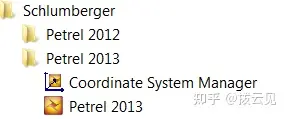
新建一个工区时,首先要选定一个坐标参考系,但对中国用户来说,商业软件很少有专门针对中国区域的坐标系统,例如我们最常用的Beijing1954。那就需要我们自定义,Petrel有一个专门工具Coordinate System Manager,它包含在Petrel的安装程序内,一般与Petrel主程序放在同一级。

Coordinate System Manager存放位置
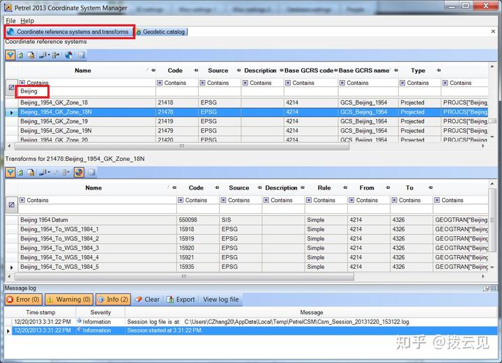
1)打开Coordinate System Manager,在Coordinate reference systems and transforms标签栏的Name下方搜索“Beijing_1954”(以Beijing1954_18N为例),寻找需要的Beijing_1954_GK_Zone_18N,确认它存在。

Coordinate System Manager主界面
2)在Geodetic catalog标签中选择Create new conflation policy。

Create new conflation policy
3)在Create conflation policy界面的Name中给定一个在Petrel的Coordinate reference system selection中用来显示的名字,如“Beijing 1954_18N”。通过搜索Select coordinate reference system中的Name找到Beijing_1954_GK_Zone_18N并选中,这时在其下方的Select transform中会自动筛选出相对应的投影系统,具体可以阅读后面的Well-known text(WKT)中的详细参数以确定哪个投影系统更准确,确定后选择OK。

Create conflation policy流程
4)重启Petrel,这时就可以在Coordinate reference system selection中找到新加入的坐标系统了。

新加入的坐标系统显示在Coordinate reference system selection中
结论:Coordinate System Manager相当于Petrel的一个坐标系统管理器,常用的坐标系统已经存在于Petrel当中,而其他坐标系统需要从这个管理器中通过上述方法单独调用到Petrel中。
免责声明:本文系网络转载或改编,未找到原创作者,版权归原作者所有。如涉及版权,请联系删